

Incoming Hurricane Could Bring Heavy Rain to Illinois
It appears that Illinois is about to be on the receiving end of some heavy rain from an unexpected source - Hurricane Isaias currently bearing down on the gulf coast.
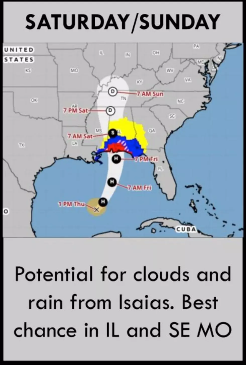
As I write this, Hurricane Isaias is takin aim at the southern Gulf Coast states - Here's the cone position shared by the National Hurricane Center

If you follow the track from the expected landfall in either Alabama and/or Florida Friday night, you can see that the storm is expected to make its way north until it reaches southern Illinois sometime Saturday night or Sunday morning. That's why the National Weather Service in St. Louis is now talking about weather impacts for extreme southeastern Missouri and southern Illinois now, too.
How much rain will Illinois receive from the remnants of Hurricane Isaias?
It's too early to know for certain as of today because the track of this hurricane is still uncertain. According to the current computer models, southern Illinois is likely to only see an inch or two of additional rain from what will then be a tropical depression. Those rainfall amounts could go up significantly if the hurricane suddenly starts tracking further to the west. That would bring the remnants of Isaias over much more of Missouri and Illinois. It's safe to expect that Illinois will see at least some rain from this hurricane. How much depends on the next couple of days as the hurricane makes its way toward landfall.
Super El Niño Could Bring Big Snow to These 10 Illinois Places
Gallery Credit: Google Maps Street View
More From 100.9 The Eagle, The Tri-States' Classic Rock Station